Please Log In Again:
Copy the Link Below to Share this Saved Map
Tracks
Track Species
Use Unique Colors
Laysan Albatross
Track ID (Year)
Show
Graph
#278 (2005)
#282 (2005)
#281 (2005)
#466 (2005)
#465 (2005)
#465 (2006)
#278 (2006)
#282 (2006)
#466 (2006)
#552 (2007)
#283 (2007)
#555 (2007)
#463 (2007)
#469 (2007)
Show / Hide All
Bluefin Tuna
Track ID (Year)
Show
Graph
#201000 (2002)
#202300 (2002)
#506600 (2006)
#508400 (2006)
#510900 (2006)
#509300 (2007)
#603600 (2007)
#604200 (2007)
#604700 (2007)
#604300 (2007)
#703700 (2008)
#703800 (2008)
#704500 (2008)
Show / Hide All
Elephant Seal
Track ID (Year)
Show
Graph
#302 (2005)
#516 (2005)
#528 (2005)
#536 (2005)
#541 (2005)
#546 (2005)
#028 (2006)
#029 (2006)
#033 (2006)
#063 (2006)
#771 (2006)
#781 (2006)
#788 (2006)
#975 (2006)
#981 (2006)
#1159 (2007)
#1266 (2007)
#1271 (2007)
#1275 (2007)
#1278 (2007)
#049 (2008)
#052 (2008)
#054 (2008)
#084 (2010)
#046 (2011)
Show / Hide All
White Shark
Track ID (Year)
Show
Graph
#005 (2005)
#501600 (2006)
#501900 (2006)
#502000 (2006)
#502800 (2006)
#600100 (2006)
#600200 (2006)
#600800 (2006)
#602500 (2007)
#702800 (2007)
#702000 (2008)
#702900 (2008)
#704100 (2008)
Show / Hide All
Drifter Buoys
Track ID (Year)
Show
Graph
#016 (2005)
#030 (2005)
#041 (2005)
#042 (2005)
Show / Hide All
Tools
Show Animal Movement:
Plotted Value:
Depth
Speed
Curviness
SST
CHL
Graphed Track:
Elephant Seal 302
Plot From
to
Start
End
Move Sliders to Set Plot Range Below
Average Value Over Plotted Range:
0
m
Overlays
1
Select Environmental Overlays
Sea Floor
SST
CHL
Show Currents
2
Select a Year & Month for SST, Chlorophyl, or Currents
Year:
2003
2004
2005
2006
2007
2008
2009
2010
2011
2012
2013
2014
2015
Month:
Jan
Feb
Mar
Apr
May
Jun
Jul
Aug
Sep
Oct
Nov
Dec
3
Hotspot Map
Show Hotspot Map
4
Explore Human Impacts
Impact Type:
None
Cumulative Human Impact
Commercial Shipping
Ocean-Based Pollution
Inorganic Pollution
Organic Pollution
Nutrient Pollution
Invasive Species
SST Anomaly
UV Anomaly
Ocean Acidification
Fishing - Demersal Destructive
Fishing - Demersal High By-catch
Fishing - Pelagic High By-catch
Fishing - Artisanal
5
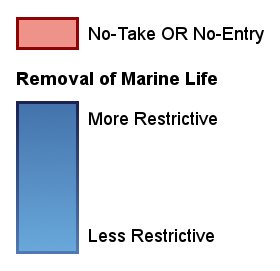
Marine Protected Areas
(Right Click MPAs for More Info)
Show Marine Protected Areas
Library
About
Species
Elephant Seal
Laysan Albatross
Northern Bluefin Tuna
White Shark
Oceanographic Factors
Bathymetry
Chlorophyll
Ocean Currents
Sea Surface Temperature
Tags
Archival Tags
Pop-up Archival Satellite Tags
Satellite Telemetry Tags
Smart Position and Temperature (SPOT) Transmitting Tags
The North Pacific Ocean
Major Currents
North Pacific Transition Zone
Upwelling and the California Current
General Ecology
Introduction
Energy and Food Webs
Levels of Organization
Curviness Tool
Hotspots
Hotspot Tool
Biological Hotspots in Ocean Tracks
Biodiversity Hotspots in Conservation
Human Impacts
Climate Change
Coastal Development
Fishing
Human Impacts Map
Invasive Species
Ocean Acidification
Oil Extraction
Pollution
Shipping
Marine Protected Areas
Introduction
Purpose and Benefits of Marine Protected Areas
Types and Design of Marine Protected Areas
Establishing Marine Protected Areas
The Social Dimensions of Marine Protected Areas
Drifters
Scientist Videos
Video Tutorials
Overview
The Tracks
The Tools
The Overlays
The Library
Interacting with Tracks on the Map